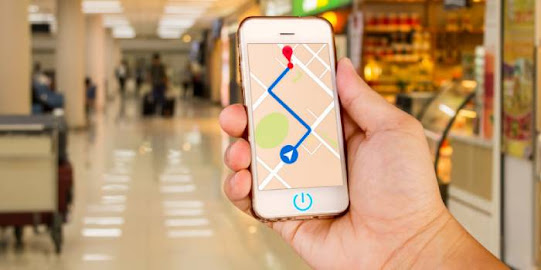
GPS Equipment & Solutions: Revolutionizing Navigation and Beyond
Global Positioning System (GPS) technology has revolutionized the way we navigate and interact with the world around us. Originally developed for military purposes, GPS has evolved into a ubiquitous and indispensable tool in various industries, from transportation and logistics to agriculture, telecommunications, and personal devices. In this article, we will explore the fundamentals of GPS equipment and solutions, its wide-ranging applications, and the transformative impact it has had on modern society.
GPS Technology Overview:
At its core, GPS is a satellite-based navigation system that
provides accurate and real-time positioning, velocity, and timing information
anywhere on Earth. It relies on a network of satellites orbiting the planet,
each broadcasting signals that are received by GPS receivers. The receivers
triangulate these signals to determine their precise location and display it on
a map interface. The system operates 24/7, making it a dependable and
continuous resource.
GPS Equipment:
A. GPS Receivers: GPS receivers are the fundamental
components that interact with the satellite signals to determine the user's
location. These receivers come in various forms, ranging from handheld devices
to in-vehicle navigation systems and smartphones. The receivers have evolved to
become smaller, more accurate, and power-efficient over the years.
B. GPS Antennas: GPS antennas are essential for receiving
satellite signals effectively. They come in different designs to suit specific
applications and environments, such as patch antennas, helical antennas, and
active antennas. High-quality GPS antennas ensure improved signal reception and
accuracy.
C. GPS Tracking Devices: These devices are used to track the
movement and location of assets, vehicles, or individuals. GPS tracking
solutions are crucial for fleet management, logistics, and personal safety
applications.
D. GPS Modules: GPS modules are compact, integrated circuits
that incorporate the necessary hardware and software to receive and process GPS
signals. They are often embedded in other devices, enabling them to add GPS
functionality quickly.
GPS Solutions:
A. Navigation and Mapping: GPS has revolutionized navigation
by providing accurate turn-by-turn directions and real-time traffic updates.
Mapping applications on smartphones and in-car GPS systems have become
indispensable tools for commuters and travelers alike.
B. Location-Based Services (LBS): Location-based services
use GPS technology to offer personalized and context-aware information to users
based on their current location. These services include location-based
advertising, geofencing, and augmented reality applications.
C. Fleet Management: GPS-enabled fleet management solutions
optimize vehicle routes, monitor driver behavior, and provide real-time updates
to enhance operational efficiency and reduce costs for businesses with large
vehicle fleets.
D. Precision Agriculture: GPS technology has transformed
agriculture by enabling precision farming techniques. Farmers can use
GPS-equipped tractors and drones to optimize planting, fertilizing, and
irrigation, resulting in higher yields and reduced environmental impact.E.
Emergency Response: GPS plays a crucial role in emergency response systems,
enabling accurate location tracking of callers in distress. This technology has
been instrumental in saving lives and providing timely assistance in critical
situations.
F. Geocaching and Outdoor Activities: GPS technology has
popularized geocaching, a modern-day treasure hunt, where participants use GPS
coordinates to find hidden containers or "geocaches" in various
locations worldwide.
G. Surveying and Mapping: GPS equipment has revolutionized
the field of surveying and cartography, providing highly accurate and efficient
methods for mapping terrain, construction sites, and infrastructure projects.
Future Trends:
A. Multi-GNSS Integration: In addition to the U.S. GPS,
other global navigation satellite systems (GNSS) such as Russia's GLONASS,
Europe's Galileo, and China's BeiDou are being integrated into receivers,
enhancing overall performance and reliability.
B. Augmented Reality (AR) Navigation: AR navigation
applications are emerging, offering real-time overlay of route information and
navigation cues onto the real-world environment through the smartphone's
camera.
C. Autonomous Vehicles: GPS technology is a cornerstone of
autonomous vehicles, providing precise location data essential for safe and
efficient self-driving operations.
D. Indoor Positioning Systems (IPS): Efforts are being made
to develop GPS alternatives for indoor positioning, enabling navigation within
buildings and dense urban environments.
Surveying and Mapping: GPS
Surveying and mapping have been significantly transformed by
the integration of GPS technology. GPS has revolutionized these fields by
providing accurate and efficient methods for determining precise locations on
the Earth's surface. Traditional surveying techniques that relied on laborious
manual measurements and the use of physical markers have been replaced by
GPS-enabled devices that offer real-time positioning with unparalleled
accuracy.
GPS-equipped surveying instruments, such as total stations
and GPS receivers, allow surveyors to precisely measure distances, angles, and
elevations, streamlining the data collection process. This results in more
efficient surveying operations, reduced fieldwork time, and improved overall project
timelines.
Mapping, too, has greatly benefited from GPS technology.
Cartographers can now create highly accurate and detailed maps by incorporating
GPS coordinates into geographic information systems (GIS). This integration
enables the creation of maps with accurate geospatial data, making them
indispensable tools for urban planning, environmental monitoring, disaster
management, and other applications.
Overall, GPS has revolutionized surveying and mapping,
making these traditionally labor-intensive tasks more efficient,
cost-effective, and accessible. Its widespread adoption continues to drive
advancements in the fields of surveying, cartography, and geographic
information systems, playing a vital role in shaping our understanding of the
world around us.


Comments
Post a Comment